We settle up at the Green Elephant (a very friendly staff and a bargain to boot). After picking up the snatch rope at the marine supply in nearby
(The N7 north with no one tailgating -- why using the paved shoulder as a "carriageway" is daunting: note the vehicle entering the highway ahead and the cyclist)
Vineyards; citrus groves; wineries; the irrigation canals and dam at Clanwilliam. Rock dassies; a kori bustard; and an ostrich.
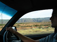
(The view from Hilux -- driving north on the N7)
We opt for the paved R357 and the
(Will at the wheel of the Hilux -- heading east on R357)
(Approaching the escarpment - Vanrhynsdorp Pass, R357)
(At the top of the escarpment -- looking west on R357)
We pound along the empty tableland at sunset, the air temperature at our new altitude having dropped dramatically, and make Calvinia just at dark.
(Empty, beautiful table land -- the Hantam Karoo before Calvinia at dusk)
We make good use of the GPS I brought along – another fortuitous piece of pre-trip prep. It becomes essential as the method by which wrong turns are eliminated, fuel stops are planned, and all anxiety is eliminated (estimating very accurately how long it will take to reach a destination versus how much day light remains). We have been warned repeatedly against driving at night.
The GPS is the Garmin GPSMAP 60 CSx bought on deep discount in the
The GPA/wiki combination allowed us to know our location at all times and to locate all of our destinations along the route (including telephone numbers) plus shopping, food (stores, “takeaway” or restaurants), fuel stops, plus other essentials including road hazards, police and veterinary road checks. The cost was nominal and (to repeat) the value enormous.
So often – within a couple of kilometers from the camp site or other lodging -- the light was failing and it was difficult to determine which unsigned dirt track to follow. The GPS always pointed us in the right direction.
Calvinia is the quintessential Afrikaner town: Trevor had described the annual braii contest/festival that is held there. The Hantam Hotel another pleasant time warp: welcoming and nice in an old-fashioned way. A youngish bar patron “well-away” loudly discusses (with us as his captive audience) what I assumed was every politically taboo subject you might list in
But this is all meant as a courtesy as American tourists traveling on their own are uncommon in many parts of
Sound asleep until awakened by mosquitoes (I had left the window open assuming it was too dry for them to breed). “Doom” – the local brand of insect spray – is effective and thankfully provided by the hotel. I decide to pick up a can at the next opportunity.
Labels: Calvinia, Vanrhynsdorp


